Mile 27


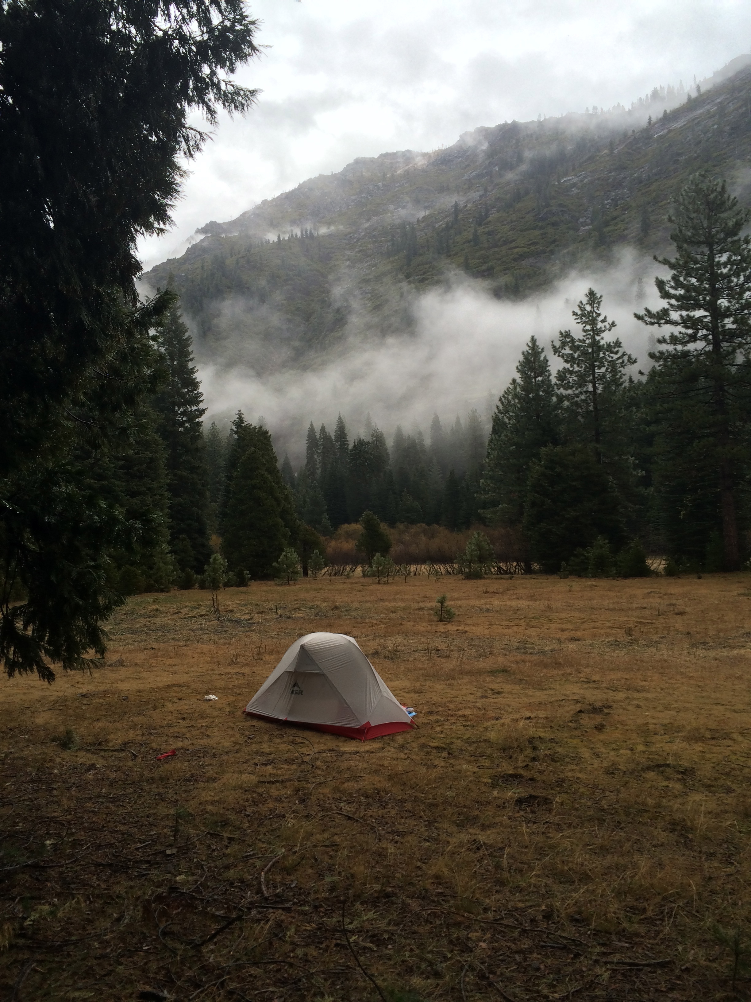
Another beautiful day in the south land with highs around 60. It rained on us some last night, and was cold, but that’s behind us now.

IMG_0133

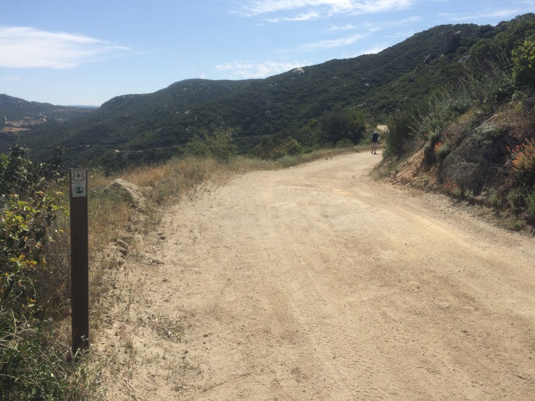
A little bit of road walking here and there.

IMG_0131

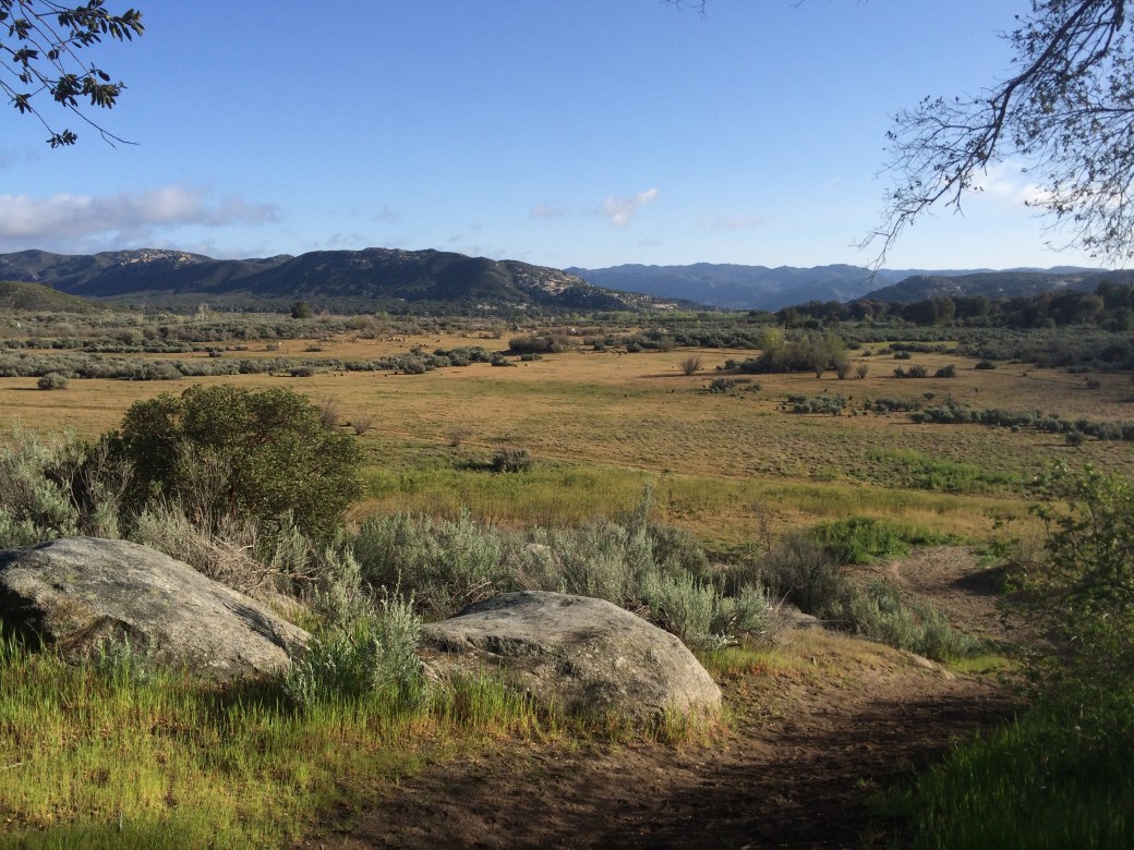
A little left of center, I’m pretty sure that’s the trail switching up.

IMG_0130IMG_0126

IMG_0134

I grew up the East Bay Area, so this terrain doesn’t seem too foreign.

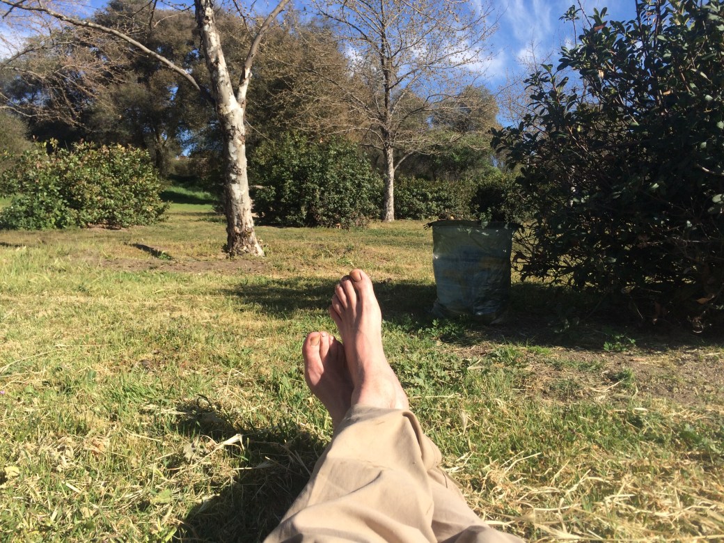
Things are going fine. I’m wicked tired and sore, but seems to be all just muscles. Feet are good. No blisters.

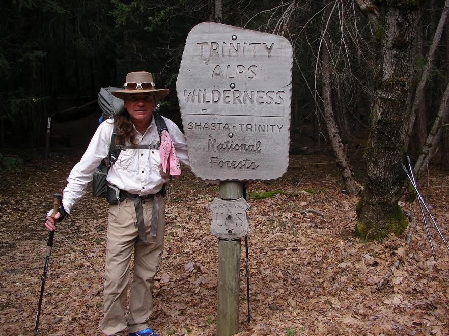
We’re shooting for MP 32 today. Then we have 10 more miles tomorrow to get our first town stop in Mt Laguna. I promise during our zero there to learn how to attach photos!

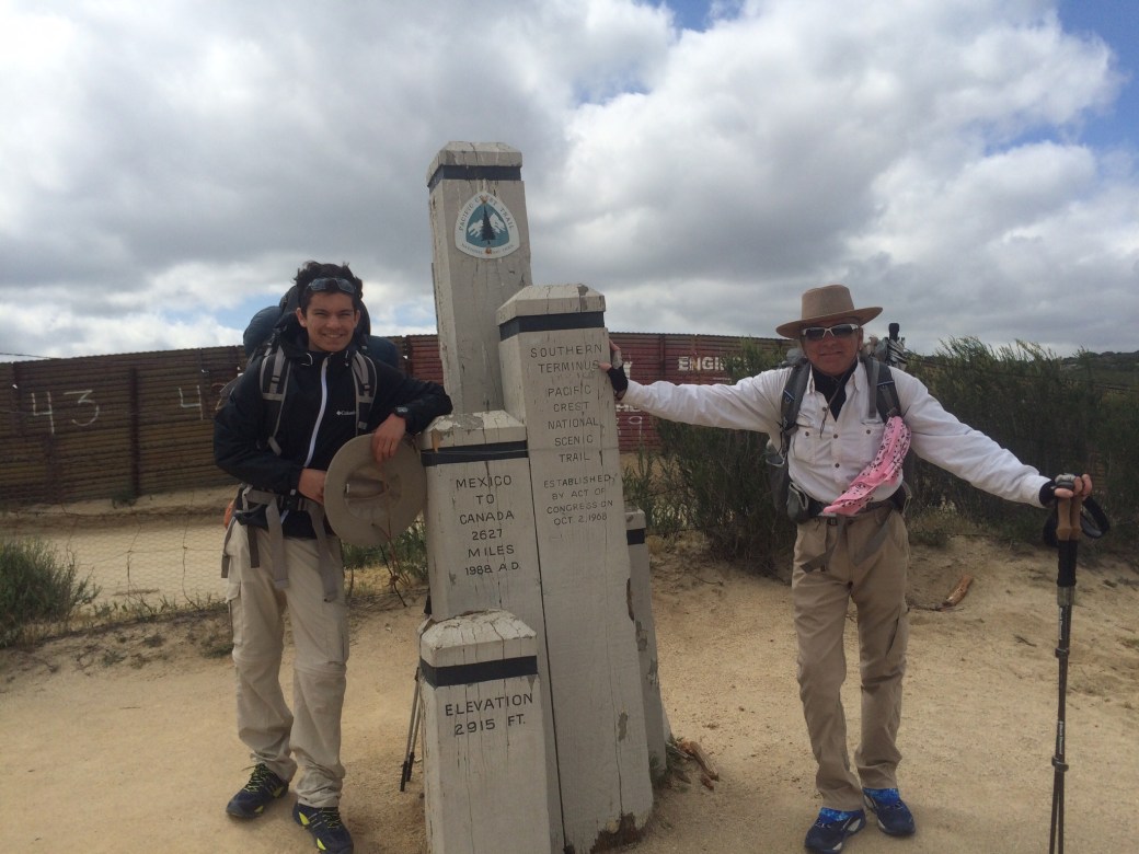
Post Trail Edit: The First Three Days

Wow, this blog is really incomplete here at the start. Let me try to fix that.

Day One

The first day went pretty well. I’ve read a lot of PCT blogs, and it was cool to see a lot of places that I’ve seen photos of, like the Mile 1 sign, and where the PCT crosses its first railroad tracks. Apparently, I didn’t take any photos on Day One myself, so, sorry about that. Our packs were heavy, but we hiked the way I used to hike when I was a teenager carrying entirely too much weight: hike for 45 minutes, then rest for 15. I can put up with a lot of suffering if I know it’s only for 45 minutes.

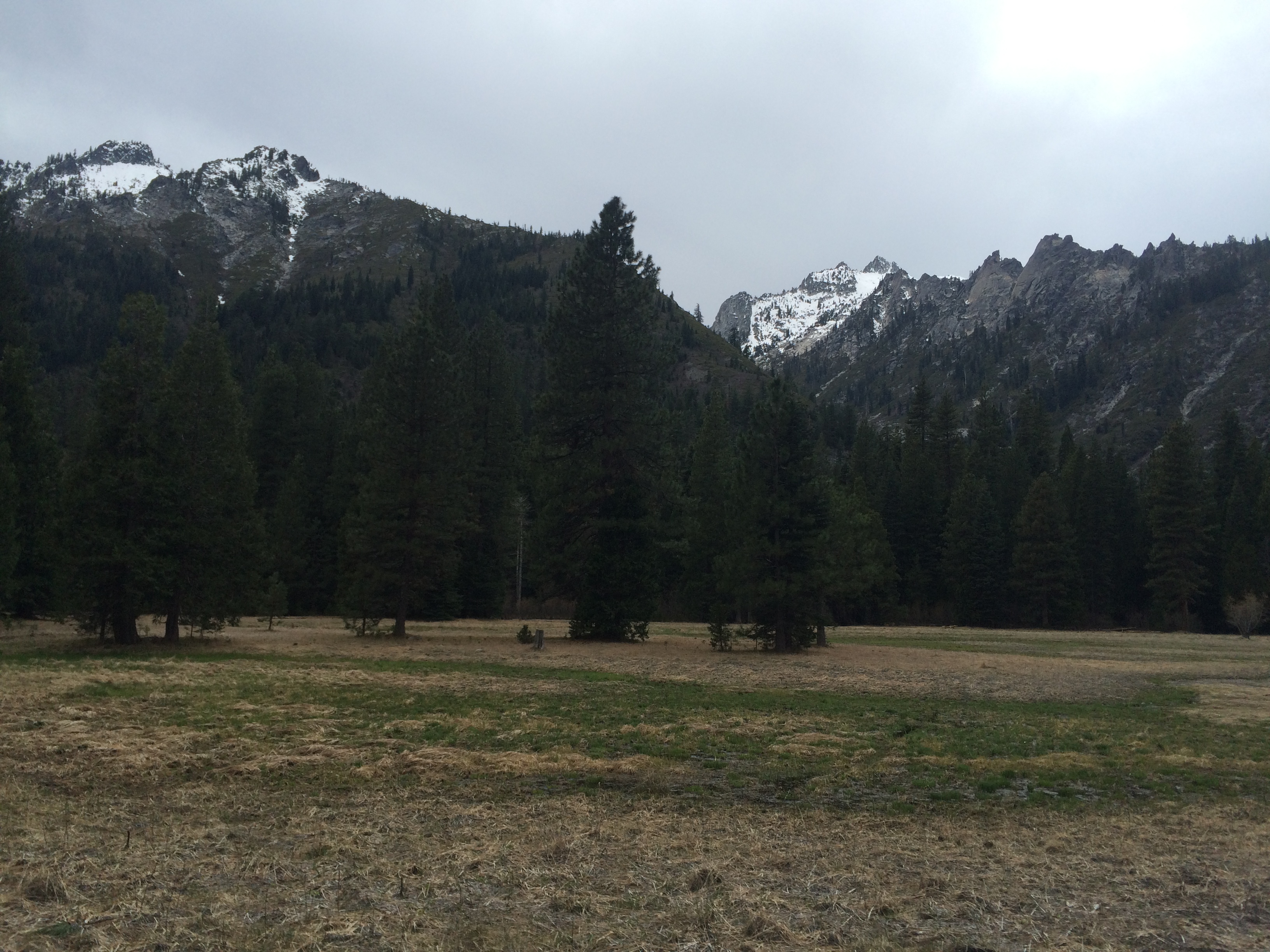
I was surprised how pretty it was. Lots of big boulders and rock, with thick vegetation and plenty of flowers. Until we walked into our first burned area, which was kind of sad looking. We had planned to hike 10 miles, but when we got there, it didn’t look promising, so we kept walking.

Around sunset, around Mile 11, I decided it was time to camp, even if we had to camp on the trail itself. I found two wide spots, big enough for one person each, about 50 feet apart so we could each bed down without blocking the trail. I gave David the bigger spot since he wanted to pitch his tent. I showed him a few tricks like check and make sure you’re not camping on an anthill, and how to stake a tent in sand, and then I went back and deployed my camp, and drank some whiskey, and ate my Subway sandwich.

I’d call Day One a success.

Day Two

I woke up to a young couple hiking by, wishing me good morning (I was “cowboy camping”, so I was right there). It was between first light and sunrise. I guess they want to beat the heat!

I got up, and at sunrise I got David up, and we hit the trail pretty early, even if I did have to chill for 30 minutes because I pack up a lot faster than David.

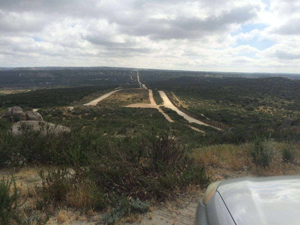
We were up pretty high, and we wandered along, and then down through Hauser Creek (dry, but with a water cache, which we didn’t need) and then up the other side. It was the hottest part of the day, and I could see up the switchbacks that some hikers had deployed their “chrome domes” for shade, but I don’t think it was much above 65F. I’m saving my chrome dome for some real, Mojave heat. Up to 100, I’m going to try to build some heat tolerance.

IMG_0137

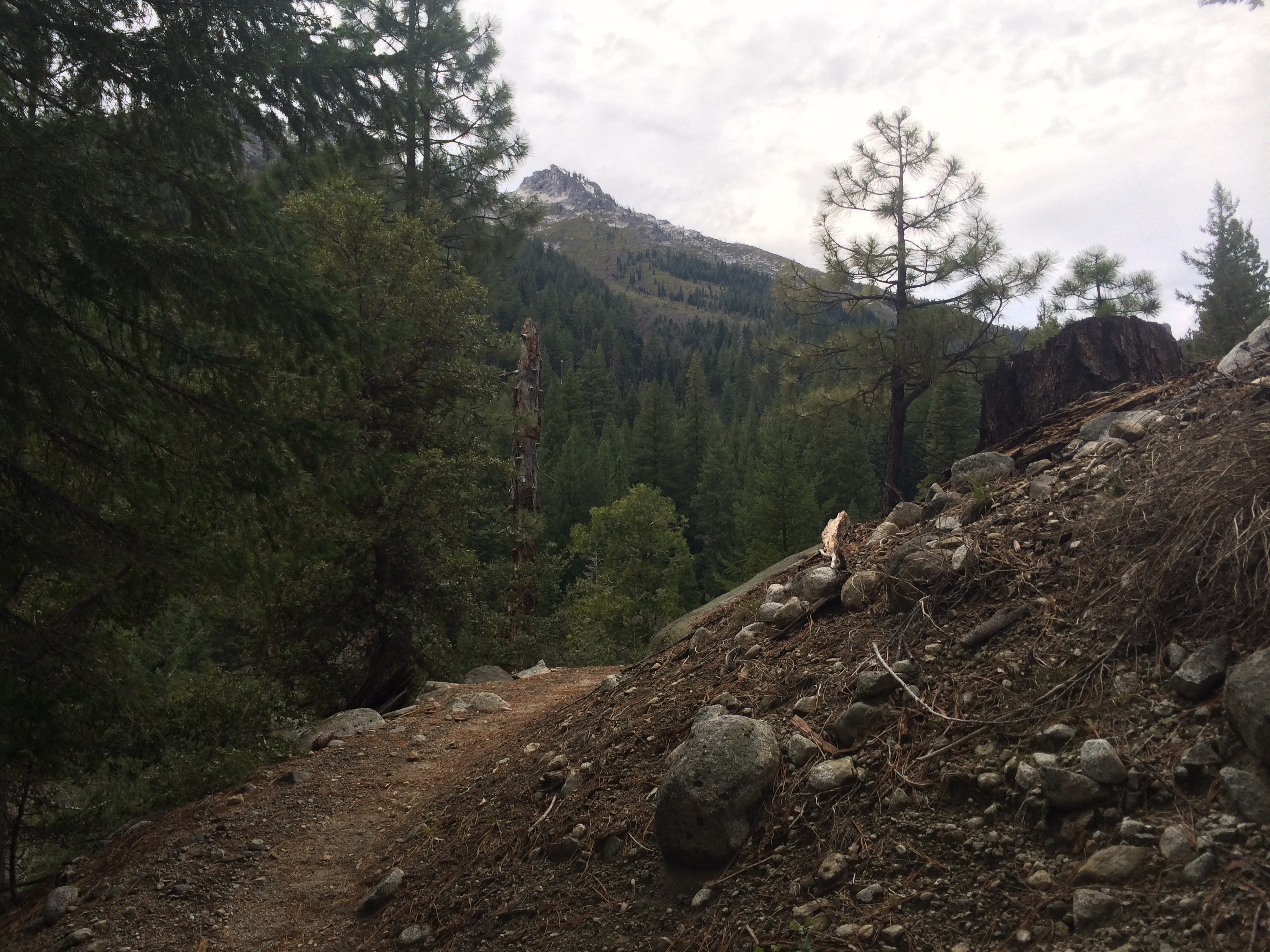
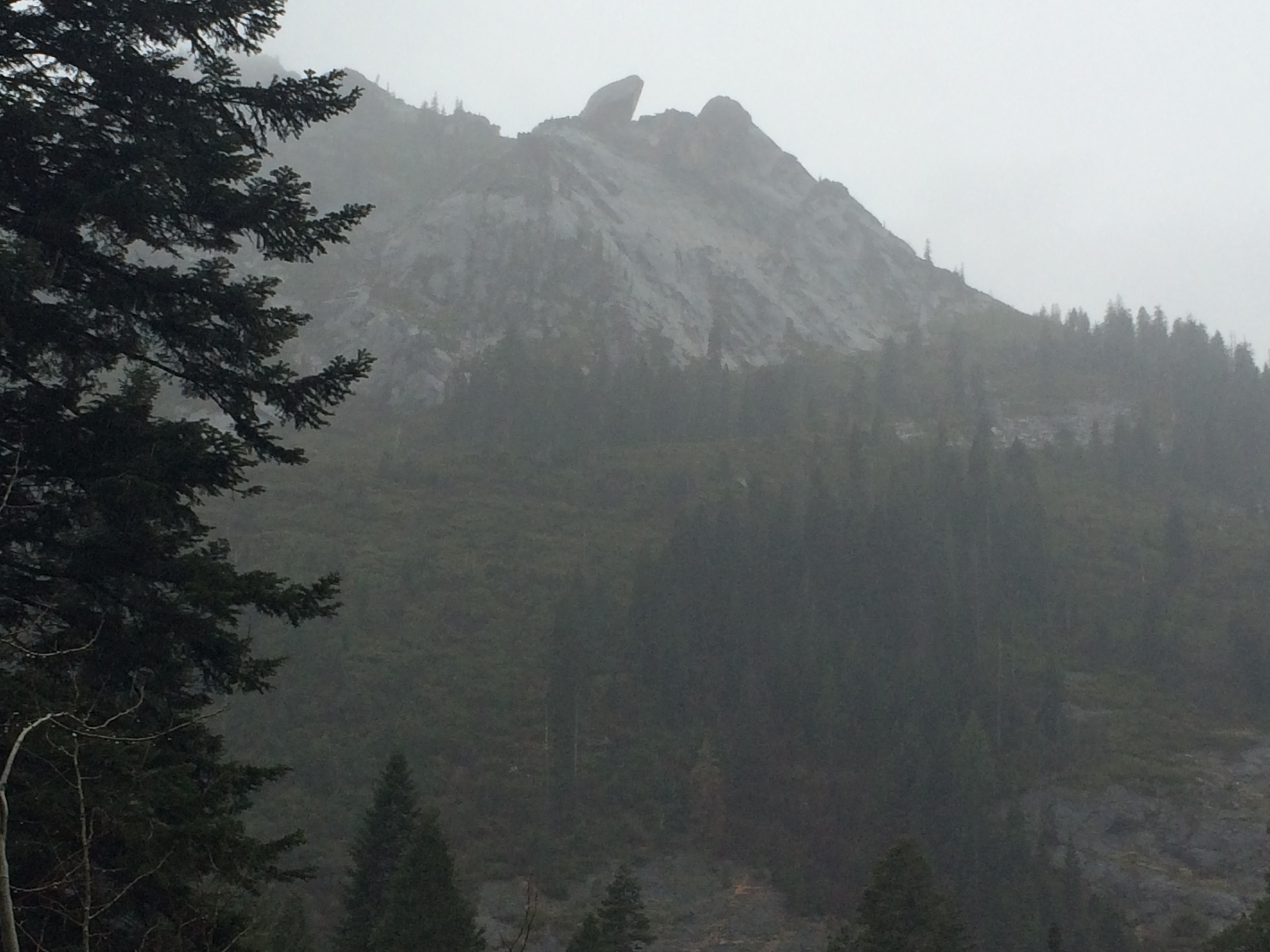
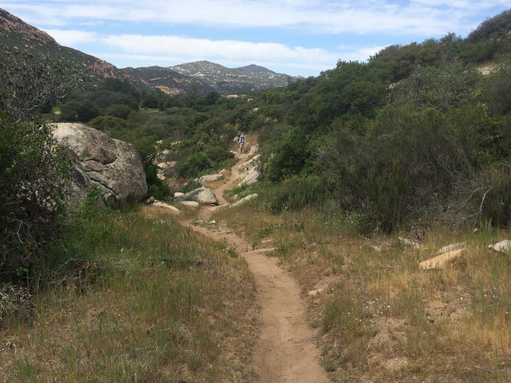
David is in the center of this photo.

We made it up and over and down to Lake Morena Campground easy enough. I think we got there around 3. The bad news is, you’re supposed to register at the office, which is like a quarter mile west, but you camp about 100 yards east from where the trail comes down. So, more walking. There’s two campsites for PCT hikers. We walked by the first one and it looked full and pretty crowded, so we walked to the one on the outskirts and it was mostly empty. I made my camp behind some bushes that blocked the wind.

IMG_0135

The cement picnic tables weren’t very comfortable, but the grass was good. I met a young couple from Redding, Junior and Jen, and I lay on the grass and talked to them while they set up their camp. Nice folks! They were the ones who walked by me on the trail this morning. I learned there was a store not too far away, and I was feeling a little rested, and a little low on whiskey, so David and I walked to the store and back.

I shared my whiskey with some of the hikers gathered under the copula as it started to rain a little. I was cowboy camped, so I ran over to my camp and pulled my rainfly over my sleeping bag. In the end, that’s how I slept: cowboy with the rainfly over me like a tarp, no tent. It didn’t rain all that much, and the bushes blocked most of the wind and a lot of the rain. I was fine.

Day Three

Everything was wet when I woke up, but not too bad. It was kind of chilly so I packed up quickly and wanted to start hiking to get warm. David was on a different schedule. After being packed up, shivering on the concrete bench for a while, I said, “I gotta go. I’m sure you’ll catch me up.” I knew the trail was just to our east, so I headed cross-country over this little ridge until I saw a heavily traveled trail heading north, which I took.

IMG_0136

It was a beautiful, flat meadow, with a clear trail, but I started to wonder. I didn’t see enough footprints. Where are the marks from the trekking poles? I checked my phone app and realized I was on the wrong trail. Crap! I can make it back to the PCT, but now I don’t know if David is ahead of me, or behind me. And he hikes fast, and he knows he’s behind, so if he’s ahead of me trying to catch up, who knows if I will ever catch him?

I scurried back to the trail and started hiking fast to try to catch him, figuring I’d rather be in front, like we planned, than be behind. Anyway, I made it. Within an hour I heard someone coming up from behind and it was him.

We stopped at Boulder Oaks Campground for water, had some lunch, and dried out some of our gear in the sun.

Later in the day we needed water, and there was supposed to be some at this stream the trail crossed. But where the trail crossed was dry. I had seen water not too far back, only it was a few hundred vertical feet down this dangerous slope, so I made us go back a mile or so, and down the scary slope, so we could get some water. It was really pretty down there. Beautiful stream. Beautiful day. I washed my feet and contemplated a swim.

IMG_0139

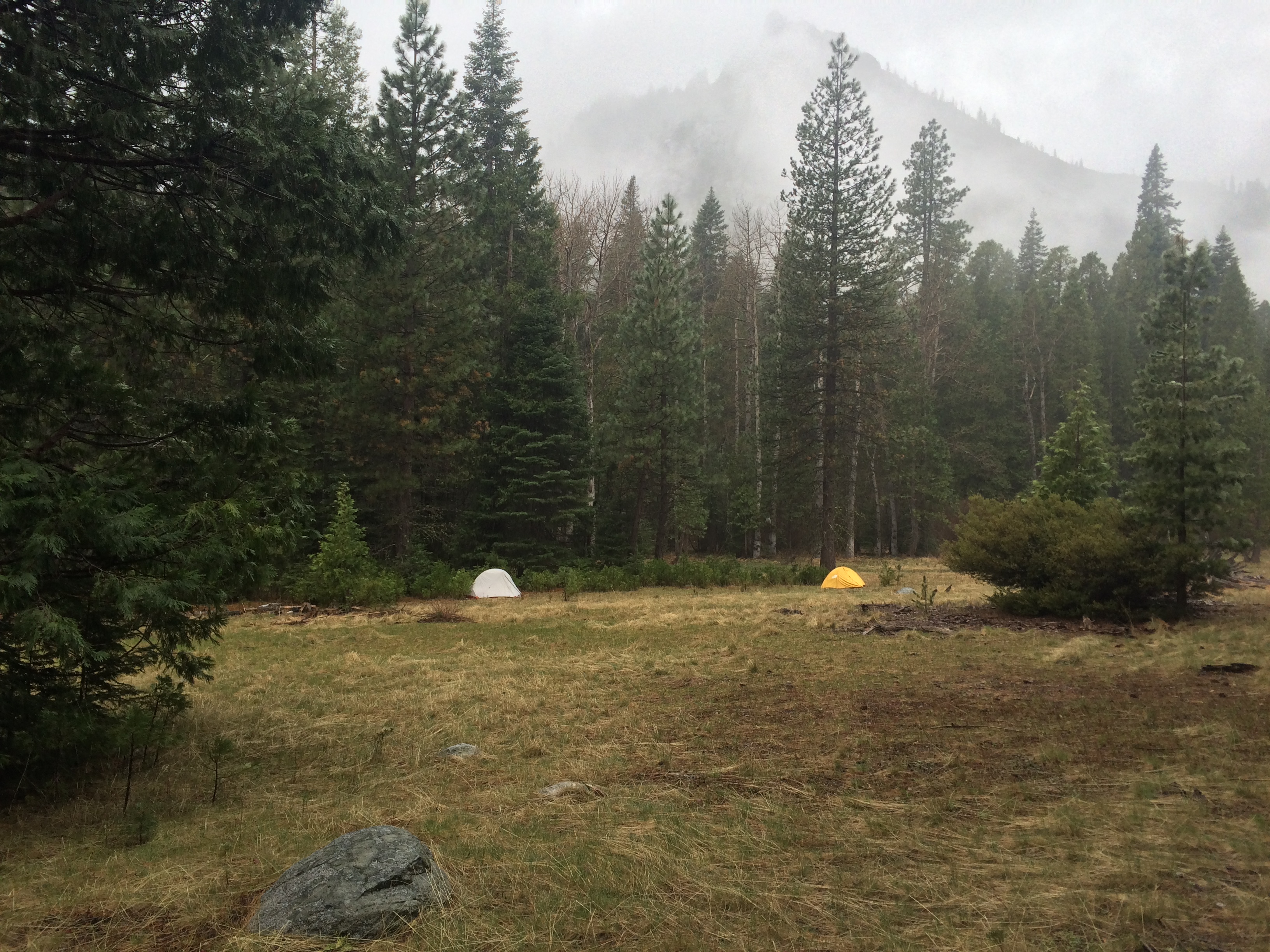
Eventually, we hiked out, and around, and made camp under some huge oak trees by a dry stream (Fred Canyon). Around sunset we got company, Andy and Alison, who were good neighbors.

13 miles to Mt. Laguna tomorrow. Mostly uphill, but shouldn’t be too bad.

On The Trail

We made it to the trail! We’re taking a break at MP 5. It’s a beatiful day, not too hot. It’s hard to make myself take breaks, so I thought while I had service I would let you all know things are going great!

image

The Start!

Post Trail Edit: Getting There

This should be it’s own post, but I don’t know how to insert new posts into the middle of the blog, if that’s even possible, sooo

My friend Chris agreed to come see me off at the start and then drive my car back home. I’ll figure out how to get home from Canada when I get there. Maybe Chris will bring my car up to Canada and pick me up.

We were supposed to leave Saturday at ten, but Chris was late. Like really late. But it was a nice day, so I just hung out on the porch in the sunshine with my cat. A bunch of my friends came by to see me off and so we all hung out and I wasn’t as bored and restless as I would have been otherwise. We finally left around noon.

My uncle drove my cousin up from the Bay Area and we met in Williams to pick him up. From there we drove to my friend Kathy’s house outside Nevada City and got there about six.

We started drinking beer and I exploded David’s backpack on Kathy’s picnic table to see what he was carrying. I removed some items from his pack, like two giant rolls of toilet paper and a huge bar of soap in one of those plastic boxes that people take camping, and a bunch of other stuff. His sleeping pad is better suited for car camping (big inflatable thermarest), so we will have to pick up something lighter on our way south tomorrow. He also needs some backpacking dinners.

Our plan for tomorrow is to drive over Donner Pass to Reno, then take 395 south down to 15 and work our way down to San Diego and then over to a little town called Alpine to stay for the night. There is a storm coming in tomorrow morning with a chance of snow. I have tire chains, even though the owners manual says not to use them. Maybe we can beat it.

Kathy made a wonderful dinner for us all, of which I ate very little, and we stayed up really late partying and talking trail, trying to explain to David what to expect. He’s never gone backpacking before. I think it was after 0100 by the time I got to sleep. Maybe 0200.

I woke up around 0700 to some light rain and leaped out of bed. No! No snow! I woke everybody up and started packing up. Kathy wanted to cook us breakfast, but I was too worried about getting over Donner Summit, which turned out to be the right decision. I’m not big on breakfast anyway. We left by 0800.

Not far out of town the rain turned to snow and I was very concerned. But it was a sleepy Sunday morning with almost no traffic. I didn’t see any plows or chain controls in place, so we kept going. I’m pretty experienced driving in the snow, and with no traffic I just took it slow and easy. We stopped at the Rest Area at the top of Donner Pass. There was maybe 1/16th to an 1/8th of an inch of snow on the ground and it was coming down pretty good. David had never seen snow falling from the sky before.

Needless to say, we made it down the other side safely, and it was smooth sailing down 395. We stopped at the outfitter in Bishop (Wilsons) and got David a new NeoAir mattress, a small pocket knife, and some food. I made sure to go slow and check out all the towns near the trail: Bridgeport, Big Pine, Bishop, Independence, Lone Pine, to get an idea which ones might be good to stop at on the way back north. I made sure to point out Mt. Whitney when we went by. The Sierra sure are impressive from this side!

Then we hit a long stretch of some serious-looking desert. Hard to think I have to walk back through this in a few weeks. It looked incredibly bleak. I went through Cajon Pass but I didn’t see where the trail crosses (near the McDonalds), probably because I was distracted by heavy stop and go traffic. Ahh, southern California! Traffic thinned out by the time we got to San Diego around dark. We headed east on I8, but when we got to Alpine there was nothing. I had seen a lodge on Google Earth, but it was dark and closed. We drove back to El Cajon or La Mesa and took the first place we could find, which was kind of seedy. It was 9 or 10 by this point.

We went out and got some beer and food and took it back to the room. I spent a good amount of time sorting and packing gear. There’s a lot of things to consider on your last night in town! I think I was up until after one again. But then, I’ve been staying up past 12 or 1 for the last two weeks trying to pull this all together, so what’s one more night?

We got up around 8 and hit the road at 0830 or 9. It was farther to Campo than I thought. We stopped and got sandwiches at Subway for dinner (in Wired’s honor), and I stopped at the Post Office and gave my bucket it’s first bounce (to Mt. Laguna). I signed my first PCT register there! As we were almost to the trailhead, I got lost on all the dirt roads. I’ve got a lot of experience driving dirt roads, so I was able to drive my low-slung, 2WD car up this rutted jeep road to the top of this nearby hill, much to the surprise of my passengers. It had a big American Flag on it. Kind of a cool spot. From there we could see the monument a few hundred yards east of us. And we could see a whole lot of Mexico. It was about 50 degrees and windy. Not what I pictured it would be like. Felt a little cold, actually.

IMG_0122

The monument is on that hill over there.

It took a few minutes to top off our water and get everything packed up just right. We’re taking 20 miles worth of water and expect that to take two days, so “dry camping”. Seven liters. Our packs were really heavy! We saw the Forest Service “trail runners” or whatever they are called. Talk about a cool job! They didn’t ask to see our permits, but just asked if we had them (at this point David actually didn’t, but we were in communication with the PCTA and hoping to get one mailed to Warner Springs). Finally, there was nothing left to do but start hiking. I think we hit the trail around 11.

IMG_0129

Let’s do this!

Continue reading

Farewells

I hate leaving. I really do. Once, even though I was looking forward to four weeks traveling in Europe with my best friend, some part of me just did NOT want to go. We had to leave at 6AM to catch our flight and I put off packing until 5. Gave myself a whole hour!

I certainly haven’t done that with this trip. I’ve been up until 1 or 2 every night for the last week working to bring it all together. I don’t know what I was thinking working at my job right up until I leave. I should have put a day or two break in there. Oh, well. Next time. I think I might be on top of it now and actually get to bed before midnight tonight.

My co-workers took me out for a farewell lunch, which was really sweet. Still sad to say goodbye. I said co-workers, but they’re actually friends bordering on family, we just happen to work together.

As I was driving home, feeling sad, one of my favorite Tom Petty songs came on the radio, like he was singing my song:

“It’s time to move on, time to get going, what lies ahead I have no way of knowing. But under my feet, Babe, grass is growing. Time to move on. Time get gone.”

I cried.

IMG_0120

Shipping Me Packages

Well, since I will be bouncing myself a box, I’ll be going through a lot more Post Offices than I had originally planned. So, feel free to ship me something, if you’re so inclined. Remember, I will have to eat it, toss it (cards & letters), or CARRY it. Please keep that in mind.

Also, if you send me something, you must tell me about it so I know to stop and pick it up! The earlier you know (like the day you ship it) the better. I may decide to speed up or slow down based on when the Post Office is open, where I am, etc.

According to those who have gone before me there is really only ONE reliable way to ship packages and that is Priority Mail. Not First Class, not Parcel Post.

Address each package:

(Hiker Name)

General Delivery

Town, State, Zip Code

Double-check the Zip Code

At the bottom left corner of each package write:

Hold for PCT hiker

ETA (date)

Also, write the last name in big, block letters on all sides of the box, in me and my cousin’s case, “DRESSER”.

I’m not totally sure which towns I will be going through, and you’ll have to follow the blog to have any idea of when I’ll be there, but here are some possibilities:

Mt. Laguna, CA 91948

Definitely staying there Thursday and Friday night next week. Better mail quick or I will miss it.

Warner Springs, CA 92086

April 15th?

Adam Dresser

c/o Paradise Valley Café

61721 Hwy 74

Mountain Center, CA. 92561

Idyllwild, CA. 92549

Adam Dresser

c/o Paul Miller

PO Box 826

Cabazon, CA. 92230

(definite stop)

Big Bear Lake, CA. 92315

Wrightwood, CA. 92397

Adam Dresser

c/o The Saufleys

11861 Darling Road

Agua Dulce, CA. 91390

Tehachapi, CA. 93561

Adam Dresser

c/o Kennedy Meadows General Store

96740 Beach Meadow Road

Inyokern, CA. 93527

That’s probably good for now. Kennedy Meadows, about 700 mile in, is “The Gateway to the Sierra”, and the end of the desert. I will definitely be stopping there, hopefully in late May. It would be cool to be there on my birthday (May 21st), but my new, slow schedule has me two days late. Guess we’ll see. Stay tuned!

Sunday Golf

Every Sunday me and my mates play disc golf up in the redwoods. It was a beautiful Humboldt County day with a little fog, a little sun, and a nice temperature. The Triliums are beginning to bloom in force, so it was nice to see that before I go.

Sunday golf is just a thing we do. Nobody calls nobody. You show up or you don’t. Sometimes it’s just two or three of us, but yesterday we were seven, so, a decent send-off. I played pretty well too!

Honestly, this post is mostly to see if I can do a post entirely from my phone. Did it work?

image

My view when I stopped to pee.

A Big Change

This hike, and this blog, have brought me back in contact with lots of old friends and family members I don’t see much, and this has been really nice.

My 17-year old cousin, who is more-or-less a total stranger to me, contacted me last week and said he might like to hike some of the trail with me. I said, “Sure, that would be fun. Best to come early before I get all burly and fast and you can’t keep up.” Then it looked like he could start with me in Campo, which is certainly early! But a good time since I will be at my slowest.

Last night I asked him how long he was figuring on being out? How far did he want to go? He replied, “Well, certainly not much past Tahoe.”

What?!?! That’s like 1200 miles!

This is obviously a huge change. I have heard how difficult it is for couples to hike the PCT together, and for that reason I deliberately did not search for a hiking partner among my friends. I planned to make friends with some like-minded hiker(s) who hike like I want to hike. I hear that is a much more successful strategy. Or just hike alone, I’m cool with that. But I’m game to give it a try.

The biggest problem at this point is he has almost no gear, not much money, and I start driving to the trailhead a week from today. We’ll work on transferring my 30 years of woods knowledge into his unexperienced brain once we’re out there, but in the meantime, just as I was seeing the light at the end of the tunnel with all my preps and plans, I feel like I am suddenly planning a whole new trip. The gear, the food, the permits, everything.

I’m not sure if this is harshing my buzz or not. I guess I really won’t know until I see what kind of person he is, how we get along, and how we hike together. Naturally, he’s being extremely deferential to my wishes, and I am free to tell him to leave whenever I want. I’m not sure that really helps, but I guess there’s not really any other way it could be.

On the plus side, assuming he likes it, this could be a huge life-changing event for David. I don’t have any children, and am not likely to in the future, so this could be a big chance for me too. I would be happy if my legacy to the next generation was to instill a love of nature and hiking in someone who would carry that love into the future. The early trips my father took me on certainly changed my life in profound ways.

So, now I will not be going alone. At least until after Tahoe (HA!). I was a hiking animal when I was 17, so I’m guessing he’s going to be waiting for me a lot. Maybe I can load him up with gear to slow him down. Stay tuned!

In the meantime, dear reader, let’s welcome David to the team! And wish us luck in our future relationship. Sometimes arranged marriages are the best, right?

The PCT does seem to have some strange magic that pulls people together…

Bounce Box

So, I’ve got everything together, it’s all figured out, all I have to do is get myself to the trailhead. Ha Ha! NOT! And what’s worse is my plans, and even my basic strategy keeps changing! I only have a week left! Aaugh!

First, I read a blog post from a dude that got his base weight (i.e., all gear except consumables like food, water, and fuel) down to 8 pounds! How cool would that be? He accomplished this by having his ultra-light buddy go through his pack and toss out a whole bunch of stuff that he probably wouldn’t need. This got me thinking that I need to do that too.

I had planned to avoid Post Offices as much as possible. Nothing like showing up late on Friday after the Post Office closes and being stuck there until Monday morning. Boo. But now I’m thinking I should have a “bounce box” for most of the trip. A bounce box is a box that you keep mailing to yourself over and over as you move up the trail. Not supposed to rain next week? Bounce the tent and rain gear. No snow next section? Bounce the snow-baskets for my trekking poles. That sort of thing. Another advantage is that I could bounce guidebooks, a keyboard for my phone, and other stuff I wouldn’t bring at all if I had to carry them. So, a bounce box will save me weight, and provide me with extra goodies when I’m in town.

Then I read this article about water treatment: http://www.lightandmatter.com/article/hiking_water.html  I’ve put a lot of untreated water through me to no ill effect, so this article was music to my ears. Last week I was thinking of buying a larger water filter. Now, I’m wondering if I want to take a water filter at all. A few drops of bleach is incredibly light, and if that works for the few times I need to treat the water, then maybe that’s the way to go? I guess I’ll start with my Sawyer Squeeze mini and see how it goes. The filter may get bounced a lot!

Then today, gratefully, I came across this blog post: http://www.halfwayanywhere.com/pacific-crest-trail/pacific-crest-trail-plans-useless/  which basically says that planning is useless and you shouldn’t do much of it. Talk about music to my ears! I have been stressing so hard about my California mail drops (I’ll figure out Oregon and Washington when I get to Ashland). I need to figure out what I will want to eat, buy it, pack it, figure out where it needs to go and when to mail it, and give it to someone responsible to mail on the given day, and do it all in the next week! On top of everything else I still need to do! Mac has freed me from this torture. I will put the mail drops together when I get close to where they need to go. Then I will have a much better idea what I’m doing, and what I want to eat (which can change over time).

This has also caused a major change in strategy. Itinerary? Pfft. Whatever. I’ll asses each day at dawn and I will do what seems right at the time. No schedules. No deadlines. I mean, that’s one of the great things about being out there, right? So you can throw your watch and your calendar away and live by the cycles of the sun and stars?

I also like this change in attitude because my foot is still hurting. My Dad (Expedition Medic) suggested riding my mountain bike to increase leg muscles without impacting my feet, and I am going to start doing this. I also put my White’s boots back on for a few days. But my greatest fear is still that I will get injured and have to quit the trail. So, I’m going to start very slowly, take it easy, and see how it goes. I’ll take a little extra food each leg, at least at first, in case I want to add a day. If want to hike faster/farther, that’s great. If it takes me an extra day, hey, that’s great too!

I had planned to leave early and hike fast for a variety of reasons (beat The Herd, beat the heat, beat the fires, beat the snow), but now I plan to focus only on how I feel. I would rather hike small miles and still get to spend the summer walking, even if I didn’t make it to Canada, than go too fast and have to quit in Tehachapi or something. I’ve been pretty athletic most of my life, so I won’t be surprised if I feel pretty good pretty fast, and want to hike big miles, but that’s up to my body, and not two arbitrary lines on a map and a calendar.

So, I guess things are going well. Nevertheless, I’m really looking forward to actually being out there and all this pre-trail stress can just go away. There’s going to be a huge sigh on April 6!

I just hope I don’t have stress dreams about this like I still do about Finals Week. That wasn’t the New Place to Dream I was thinking of!

Fitness

I thought it would be my knee. I hurt my knee in a skiing accident when I was around 14 and it hurts from time to time. But so far, any pain during training has been mostly from the ankles down. Mainly my left foot.

I don’t think it was a mistake to train up to take the Forest Service “Pack Test” at the arduous level. This gave me a clear goal and tight timeline. I do, however, think it was a mistake to do nearly all my training on pavement. I’ve heard thru-hikers complain about road walks, and now I know why. I’m certain this was the proximate cause of my left foot pain.

So, I took the Pack Test on Wednesday, and then went backpacking Friday through Sunday, and put a hurt on myself. The next Monday and Tuesday I could barely walk because my calves were so sore. But muscle pain and soreness don’t worry me too much. By Wednesday my calves were feeling better, and that’s when I noticed the pain down at the bottom of my shins, just above the ankle. The expedition’s Chief Medical Officer (my Dad) diagnosed me with mild shin splints.

So, instead of building strength and endurance, I spent most of last week resting. I certainly don’t want arrive to the trailhead already injured! I won’t make it to Canada if get hurt in the first few weeks.

I know it’s true that there’s no real way to train for walking all day every day other than to do it. But I also know that you can’t be in too good of shape to start something like that. But I’m told that there’s just not time to heal on a thru-hike, so start slow and don’t get hurt.

I’m in spot I didn’t see coming a month ago, wondering how much I can push it. How much I need to push it. And how much is too much?

Considering the limited number of hours left before my feet hit the trail and all the things I still need to do before I leave, the amount of training I do is probably going to be pretty limited anyway. Wish me luck.

Gear Talk

I’m not going to do a full gear rundown, but I’ll talk about the big items and what I learned last weekend on my shakedown cruise.

Pack: Gossamer Gear Mariposa. I love this pack. Very comfortable up to 35 pounds (haven’t tried it with more). I love all the pockets and the overall design. I wish it had one more small pocket, like right above the outside mesh pocket, for small thin stuff like my “wallet”, maps and permits.

Tent: MSR Hubba. Some might call that overkill, but I decided early on I don’t want to skimp on shelter. If it’s really bad, and I need to take shelter, potentially for quite awhile, then I want a place to retreat to that’s cozy. It certainly wasn’t overkill last weekend and I’m sure I’ll be glad to have it in Washington (if it rains, HA). It did really well in the rain last weekend. Actually, with the nice vestibule and the other design features, I was very pleased with this tent. Not sure how it could be better.

Sleeping System: I hate tents, actually, so if I think I can get away with it, I will be sleeping with my 4×6 piece of Tyvek (I can’t believe how perfect this is – does the job, easy to manage, and very light and small), a ThermaRest NeoAir (also love), and a Zpacks 10-degree down bag. Still not sure about the bag. I’m skeptical that I would be warm in there at 10 Degrees. But, it is true that so far all the nights I’ve used it I have not zipped it up but just used it like a blanket, so maybe zipped up it will be warmer. And hey, it probably won’t get below 20 on the PCT anyway.

After last weekend, my favorite piece of gear is my ChromeDome umbrella, which I can strap to my pack for hands-free dryness. So awesome! I recently heard that the word umbrella comes from umbra (Latin?) meaning shade. Can’t wait to deploy it in the desert and see what portable shade is like.

I’m carrying an iPhone 5s, which will be my phone, camera, GPS, map, compass, and means to blog. Don’t worry, I’m carrying this huge rechargeable battery/charger. It’s probably more power than I will need, but I won’t have to worry about it and can maybe use the extra juice to make friends or barter some food (HaHa).

Shoes: Brooks Cascadia’s seem to be the most popular, so I’m starting with those for now. It’s taken me a few rounds to find the right insoles, but I think I have it dialed in now. They seemed kind of slippery on wet painted surfaces around town, which made me nervous, but they seemed to do OK on the wet rocks last weekend, so that’s good.

Filter: I used the Sawyer Squeeze mini last weekend, and was disappointed with how slow it was. I’ve had it for a while, and maybe I’m not back-flushing it enough. It was plenty fast the first time I used it. Still, I’m thinking about getting the larger version. I’m willing to trade a few ounces for the time it will save me. I do like the ability to gather the water and filter it later, like in my tent or on a break. We’ll see if the filter makes it to Canada or if I switch to bleach or something else.

I’m not sure what to say about my kitchen, because I’m not sure I’m happy with it. I have a Jetboil Sol (titanium) which rocks if all you want to do is boil water, but I may want to actually cook something, so we’ll see.

As with all my gear, and all my plans, I’m willing for it to all go out the window as needed. My main plan is to be flexible in all things. If something isn’t working, I’ll change it. But I’m hopeful that I have things pretty close already.

Trinity Alps Shakedown Hike

The idea: Take my exact PCT rig out on a test run so I can identify any issues while I still have time to do something about it. Basically, a gear test. And of course to train and get some miles in. I went with my friend Rob, who I hiked with before in November.

The Plan: I have a meeting in Redding on Monday, let’s leave early Friday, spend three nights in the woods, hike out early Monday, I’ll go to my meeting, and we’ll drive back to the coast. The Trinity Alps is about two hours east, Redding about three. Well, it didn’t work out that way.

First, I realized my PCT gear is for two things only: Hiking & Sleeping. The forecast was for rain beginning Saturday around midnight until late Sunday, and I knew we’d be doing a fair bit of camping (i.e., not hiking until dark), so I immediately said to hell with my base weight and added a pile jacket and pile pants. I was really glad I did that.

Driving out to the trailhead was nice enough. Some weak sun through high stratus clouds. Traffic was light as we drove along the Trinity River. The Redbud is really starting to bloom.

The Trinity River with Redbud blooming.

The Trinity River with Redbud blooming.

We hit the trailhead around 1230. I had done the Pack Test on Wednesday (3 miles, 45 pounds, 45 minutes) to qualify as a Fire Fighter Type Two for the Forest Service (and to give me a goal to train up for) and my left foot in particular was hurting. My main goal this trip was to NOT hurt myself. So, we started slow.

Here we go!

Here we go!

An hour and a half in, I wasn’t happy with how my foot was feeling. We took a break. I don’t know if it was the 200mg of Vitamin I or the shot of whiskey, but I felt much better! We picked up the pace as we walked up Stuarts Fork of the Trinity.

Stuart's Fork

Stuart’s Fork

The trail was mostly through the forest, which didn’t do much for the view, but was nice on the feet.

Heading higher.

Heading higher.

I became determined to make it to Morrison Meadows, no matter how bad my feet felt. I decided we would just take a rest day tomorrow, if needed. So, we made it to Morrison Meadows kind of late. There was no obvious place to camp, so we kept walking. And walking. Tons of meadow, no camps. And daylight burning.

IMG_0092

Yay! for bridges!

IMG_0097

Morrison Meadows

Morrison Meadows

Morrison Meadows

We ended up walking all through the meadows and past them when we realized: a) it was getting dark fast, and b) we need to camp, but we need water! We stumbled back to the meadow, went downhill off trail until we found water and called it good. I had just enough time to throw the hangin’ rope (bear hang) before it got dark.

By the way, we didn’t see much wildlife, but on our first pass by this campsite we saw a black bear. Pretty big, definitely an adult, and black as night. He was already running off before we saw him so I didn’t think he’d be any trouble. And he wasn’t.

So, water. Dark, mushy meadow water. The stream was just barely oozing out of the ground. I dipped my water bottles in, but when I tried to filter them, the filter became clogged almost immediately. I had about 0.25 liters to get me through the night. It seemed like the water oozed out the meadow just upstream, so I deemed it a spring and drank the water unfiltered. We’ll see how it goes, but I’m not too worried.

Since it wasn’t supposed to rain until tomorrow night, I deployed cowboy style as always (i.e., no tent). I heard my tent has a way to pitch just the rain fly, so I did that, figuring I could pull it over me if it rained. I was in bed about five minutes when it started to rain. So, I pulled my contraption over me and saw right away that wasn’t going to work. So, I had to rally and tear it all down, put up the tent, put on the rainfly (which I did upside down and backwards, then right side forward but upside down, then right side up and backwards, then the way it’s supposed to go – yeah, fun times in the dark and the rain). It rained off and on all night. Sometimes pretty heavy. Nice being safe in my tent. (I’ll do a gear review in a couple days).

IMG_0105

Morning Sunshine! er…

Woke up to clouds and intermittent rain, so we decided to hike to Emerald Lake on a day hike and not move camp. It started raining in earnest just as we were leaving, and I rigged up my trekking umbrella to my pack and it was AMAZING! I was able to hike in my regular shirt, no rain coat, and I was totally dry above my waist. The problem with hiking in the rain is you get too hot with rain gear on, and you get too wet if it’s not on. The umbrella solved that problem. I was in heaven. I’m never going ‘packing without one again. Sorry, no picture.

We took a break and finally looked at the map and realized we weren’t going to make it to Emerald Lake. I thought it was like 3 miles, but the map said it was 5 miles. That’s 10 round trip. And my foot was hurting. And there was a crazy amount of blowdown on the trail to climb over/around. And it was pouring down rain. We decided to hike back to Morrison Meadows and maybe move camp to a place more amenable to having a fire. Sounded good. What else are we going to do? Hide in our tents?

IMG_0106

Let’s hike up there and see if we can push it over!

IMG_0109

Camp One

We hiked back and right past Camp One and all around the meadow and checked out all the sites until we found one we liked (probably two miles until we got back to Camp One), packed up in the rain, then moved another mile to the new spot. So much for a rest day!

Camp Two

Camp Two

After I set up my tent in the meadow and put some dry clothes on, and my rain gear so they would stay dry, I set about making a fire. All the wood was soaking wet. We found a few dry-ish pieces, but it was pretty grim. I had brought a cubic inch of fire-starter (wax and sawdust), and it was barely enough. I was on my hands and knees in the mud for at least an hour, blowing and poking. I was giving up when I gave it one last blow and managed to bring it around.

We had fire! It was a needy fire though. Pretty much every three to five minutes it needed tending. And every ten minutes it was time for another wood run. Not very restful, but the heat was nice. I think I hurt my back dragging and breaking and poking all that wood. And my hands were covered in pitch and mud for hours. But it stopped raining around five, and I was pretty dry by the time I went to bed at seven.

I had some dark thoughts in that twelve hours of tent time. This is kind of tough. Do I really want to leave home and live outdoors for six months? But you know? It all dissolved when I hit the trail again. The weather was perfect for hiking (overcast, 50 degrees, good humidity), and I just hit this nice endurance pace. A pace I could keep up all day. And I did. I hiked that 8.7 miles back to the car in one go with no stops. Four hours 15 minutes. Got there by 12:20. I was hurting the last mile, but I made it.

Bye Trinity's. See you next time.

Bye Trinity’s. See you next time.

LOVED my pack (Gossamer Gear Mariposa). Felt really good the whole time. When I got back, my pack weighed 29.2 pounds. That includes a wet tent, wet rainfly, and wet ground sheet, some water, and almost seven pounds of food I didn’t eat, but that’s another story. But that’s what I carried for four hours. So, base weight around 20 pounds maybe ? It felt fine to me. Bring it.

Home now. Nothing a big claw-foot bath soak can’t cure. We’ll see how I feel tomorrow. All I have to do is drive to Redding and go to that training and drive back. Should be a good rest day.